


Spodosols
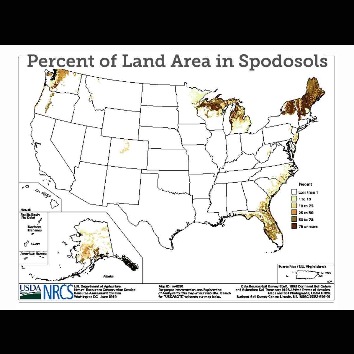
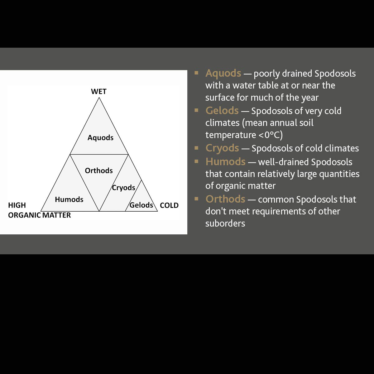
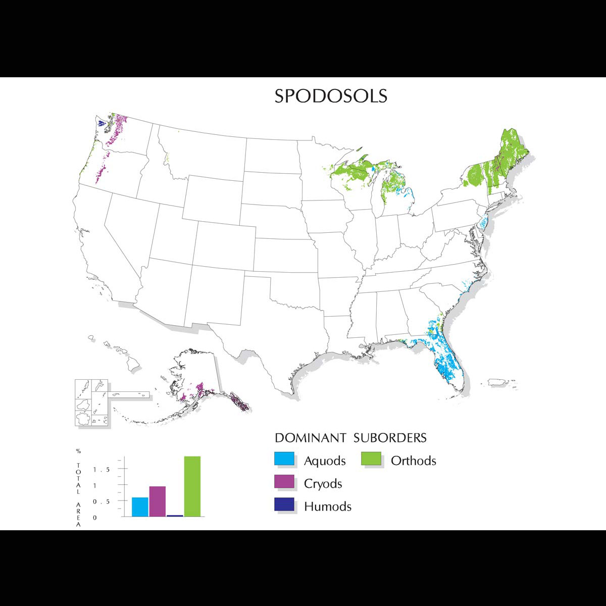
Spodosols (from Greek spodos, "wood ash") are acid soils characterized by a subsurface accumulation of humus that is complexed with Al and Fe. These photogenic soils typically form in coarse-textured parent material and have a light-colored E horizon overlying a reddish-brown spodic horizon. The process that forms these horizons is known as podzolization. Many Spodosols support forest. Because they are naturally infertile, they require additions of lime in order to be productive agriculturally. They are divided into five suborders: Aquods, Gelods, Cryods, Humods and Orthods.
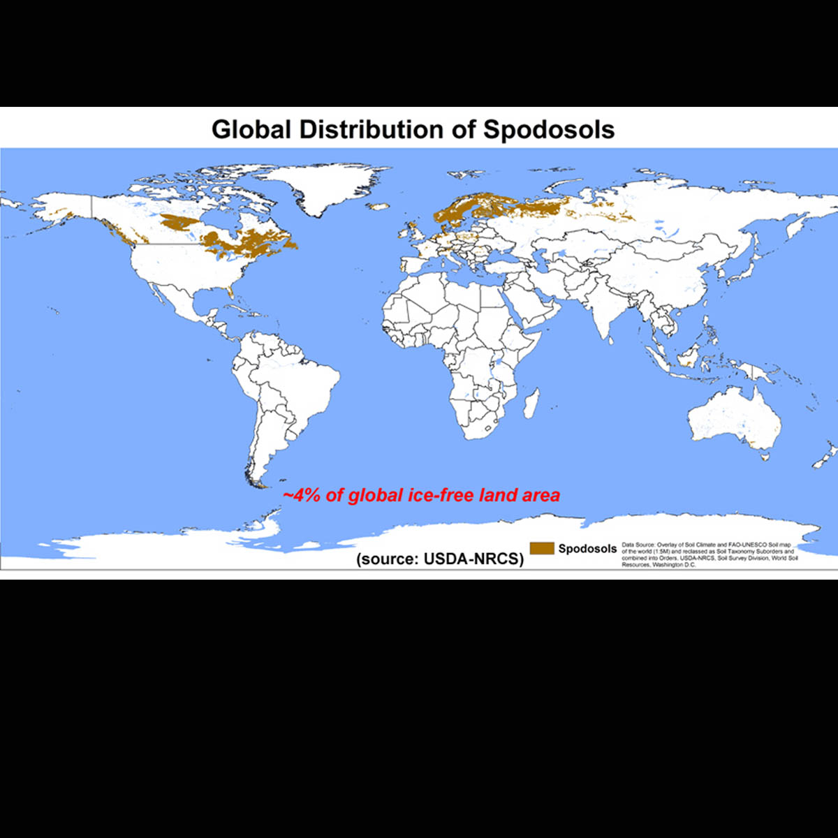
Spodosols often occur under coniferous forest in cool, moist climates. Globally, they occupy approximately 4% of the ice-free land area. In the U.S., they occupy approximately 3.5% of the land area.

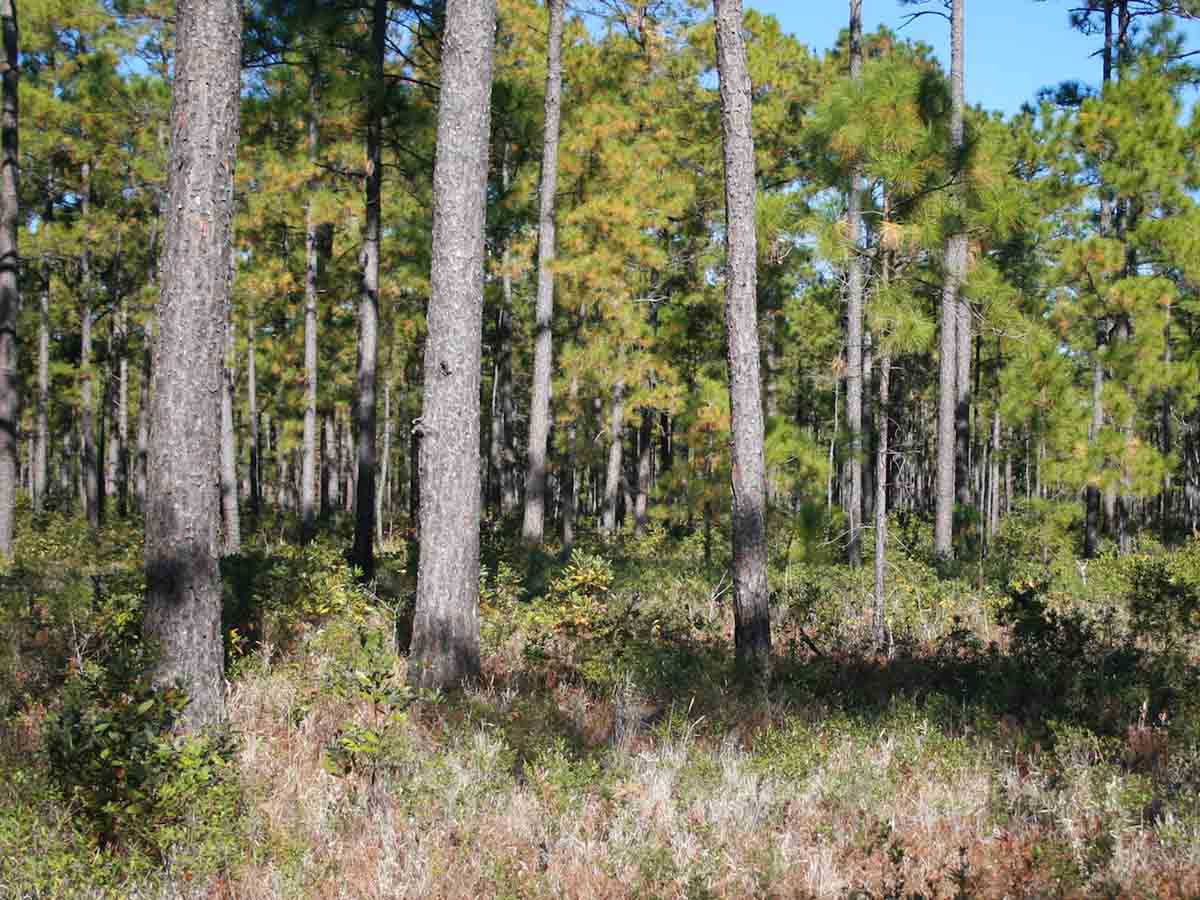
Alaquod Landscape, North Carolina — This coastal plain landscape is typical of what is referred to as the Atlantic Coast Flatwoods. Unconsolidated marine sediments are the dominant soil parent material. Mean annual precipitation ranges from 1,120-1,450 mm (44-57 inches) and soils have either a udic or aquic soil moisture regime. Most of these landscapes are forested, with loblolly pine (Pinus taeda) a dominant species on uplands and water tupelo (Nyssa aquatica) and bald cypress (Taxodium distichum) among the trees found in the lower-lying areas. (Image courtesy of John Kelley, USDA-NRCS)
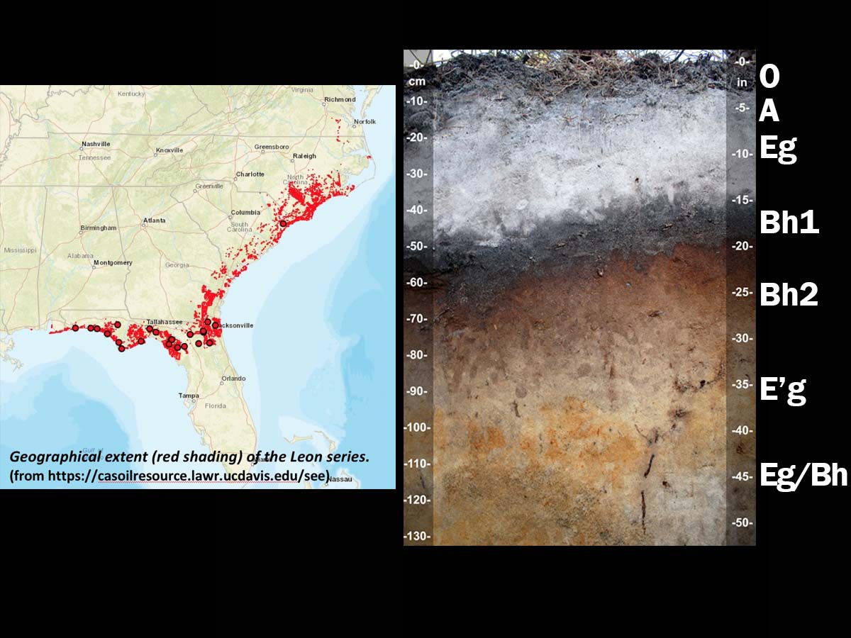
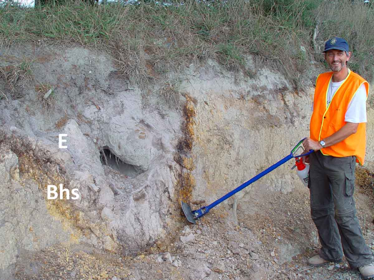
Aeric Alaquod (sandy, siliceous, thermic), North Carolina — This very deep, poorly drained soil is a member of the Leon series, which is quite extensive in the southeastern US. It forms in sandy marine sediments on upland flats, depressions and stream terraces on the lower Atlantic and Gulf Coastal Plains. The Fe content of the spodic Bh horizons is relatively low as a result of the poor drainage. Podzolization in these soils likely reflects both downward movement of organic matter and Al as well as the effects of a fluctuating high water table containing dissolved organic compounds. (Image courtesy of John Kelley, USDA-NRCS)
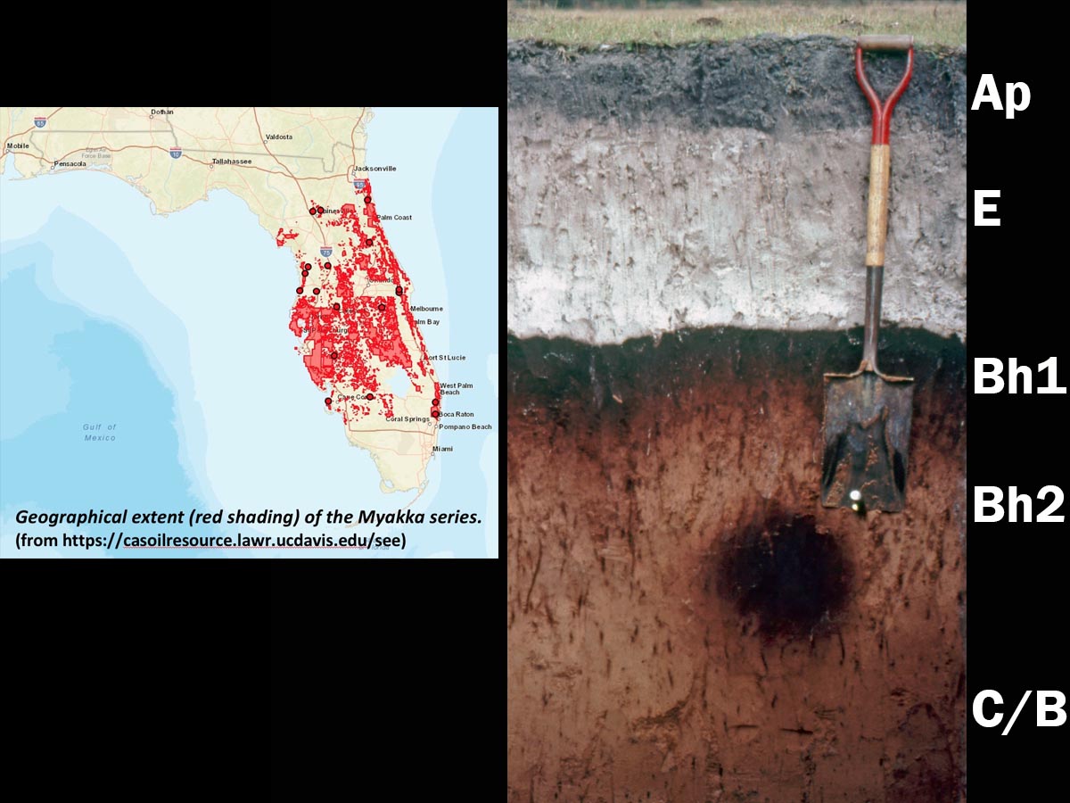
Aeric Alaquod (sandy, siliceous, hyperthermic), Florida — This very deep, poorly drained soil is a member of the Myakka series, which is the Florida state soil. It has formed in sandy marine sediments and found throughout the flatwoods of Florida. A thick albic (E) horizon and spodic (Bh) horizon are both strongly acidic with pH values typically ranging between 3.6-4.5. The dark circular zone located just below the shovel is a krotovina that has been infilled with spodic material. Shovel for scale is approximately 1 m (39 inches) in length. (Image from USDA-NRCS)
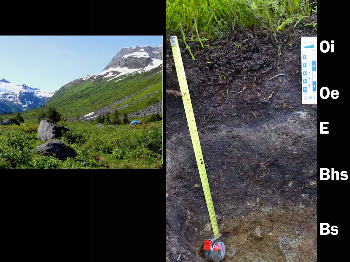
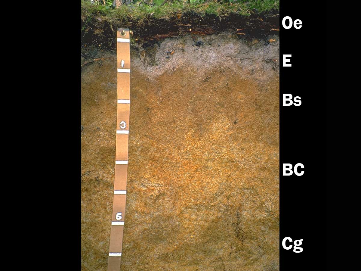
Humigelod, Alaska — This landscape and soil are from the Juneau Icefield in southeastern Alaska. The soils have formed in colluvium and glacial till and have a gelic temperature regime (mean annual soil temperature less than 0°C). However, the profile lacks evidence of frost churning (gelic materials) and permafrost is deeper than 1 m so these soils are not classified as Gelisols. Considerable carbon is stored in this soil. The surface organic layers are 20 cm (8 inches) thick. The spodic Bhs horizon contains 9.4 percent organic carbon, resulting in the Humi- great group classification. Mineral horizon textures are loamy sand and sandy loam. The soil profile shown here is approximately 62 cm (24 inches) deep. (Images from University of Idaho)
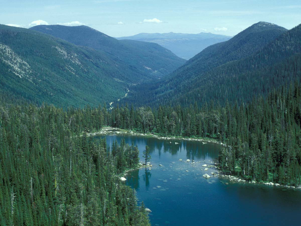
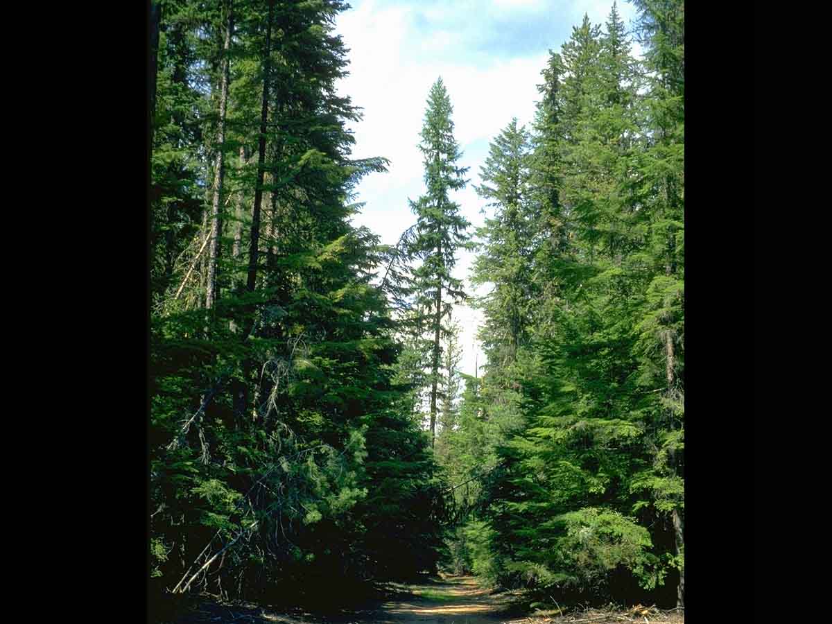
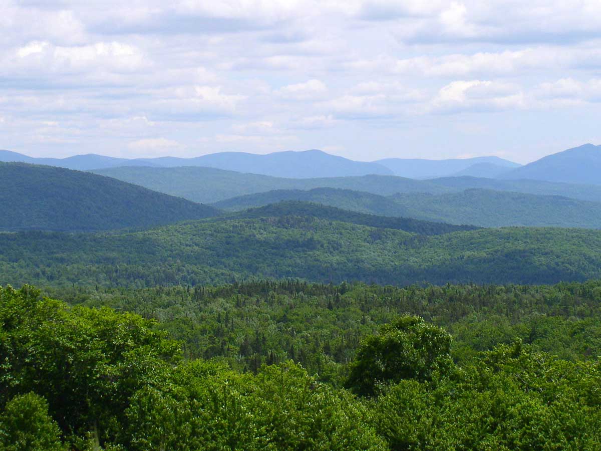
Cryod Landscape, northern Idaho — Volcanic ash overlies or is mixed with glacial deposits throughout much of the Selkirk Mountains of northern Idaho. Andisols are found at the relatively warmer and drier lower elevations. At higher elevations, greater precipitation and snowpack along with colder temperatures promote the podzolization process and Spodosols are formed. The environmental conditions that favor Spodosol formation are associated with subalpine fir (Abies lasiocarpa) and Engelmann spruce (Picea engelmannii) forest communities. (Image from University of Idaho)
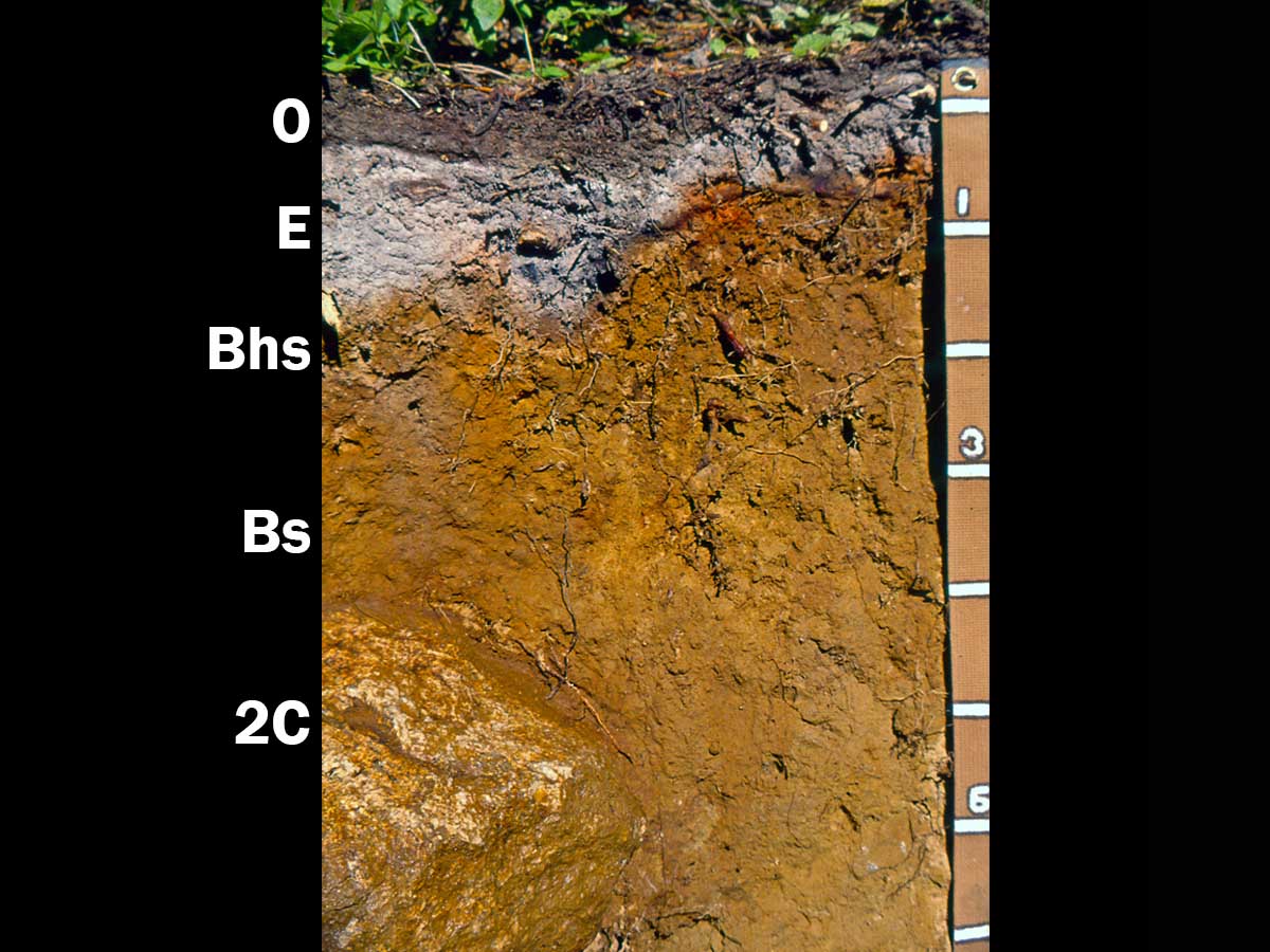
Andic Haplocryod (medial over loamy, amorphic over mixed, active), Idaho — This soil is found at approximately 1,830 m (6,000 ft) elevation in the Selkirk Mountains of northern Idaho. The upper part of the soil contains significant quantities of volcanic ash from the eruption of Mount Mazama and is underlain by very coarse-textured glacial till derived primarily from granite of the Kaniksu batholith (note boulder at bottom left of photo). The E and Bhs/Bs horizons have loam or silt loam textures and contain 25-30 percent volcanic glass. The E horizon has a pH of 3.7 and the Bs horizon has P retention of 95 percent. Scale is in decimeters. (Image from University of Idaho)
Cryod Landscape, northern Idaho — This nearly level landscape consists of coarse sandy alluvium and glacial outwash from the surrounding mountains. Mean annual precipitation is approximately 965 mm (38 inches), much of which comes as snow. Mean annual temperature is approximately 5°C (41°F). Forests of the area include western redcedar (Thuja plicata), western hemlock (Tsuga heterophylla) and Engelmann spruce (Picea engelmannii). The sand textures, coniferous vegetation, relatively large snowpack and cryic temperature regime provide the conditions needed for podzolization to occur. (Image from University of Idaho)
Aquic Haplcryod (sandy, mixed), Idaho — This soil is formed in coarse sandy alluvium. A thick mat of Sphagnum covers much of the soil surface. Coarse and very coarse sand make up 62-88 percent of the soil on a weight basis. Nearby loamy soils do not have an E-Bs horizon sequence, underscoring the strong influence of coarse textures in promoting the podzolization process. This soil has very low native fertility, with pH values ranging between 3.4-5.2 and very low quantities of plant-available Ca, Mg and K. (Image from University of Idaho)
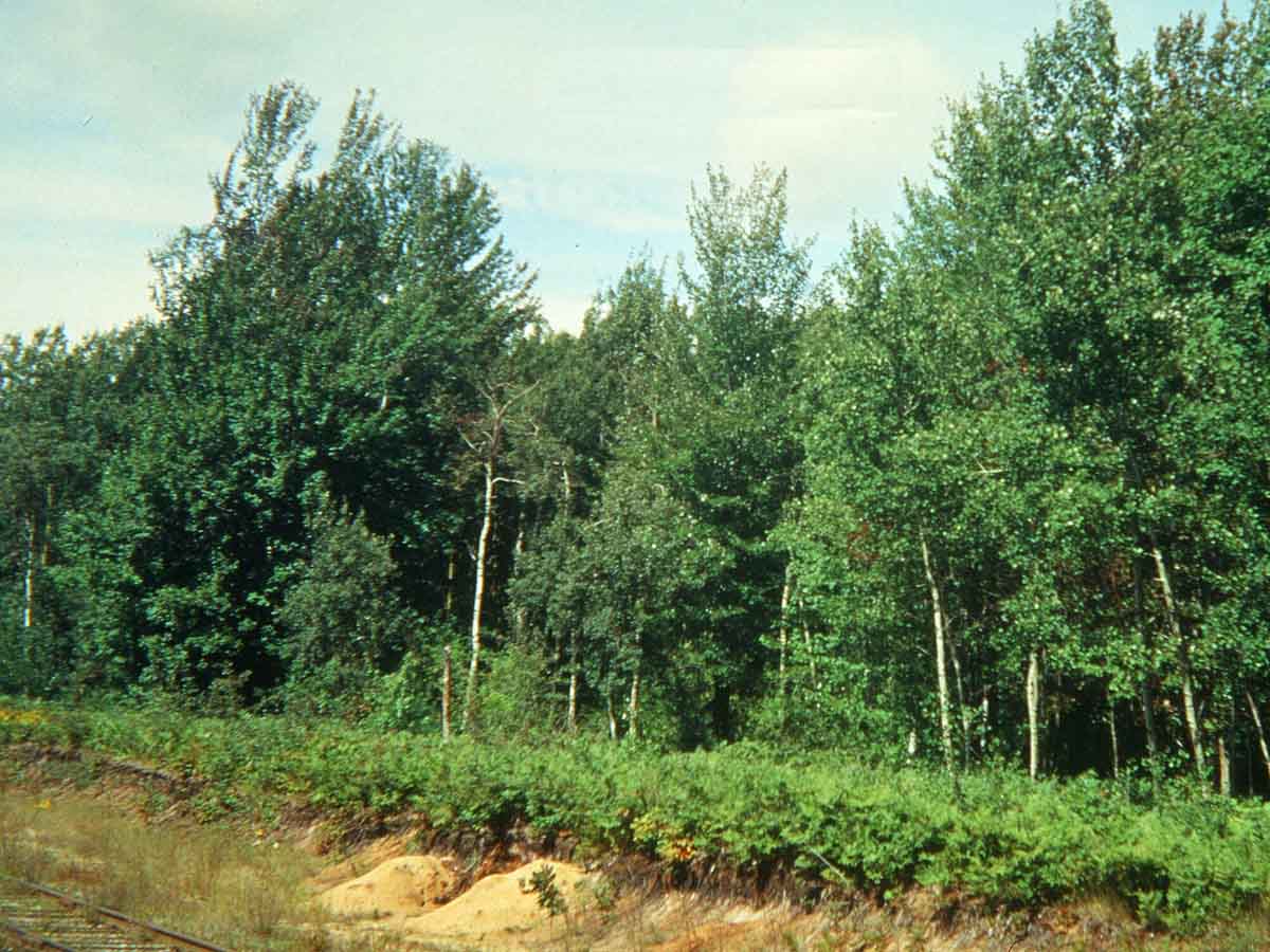
Orthod Landscape, Michigan — This landscape consists of old sand dunes, lake plains and glacial outwash plains. Mean annual precipitation ranges from approximately 685-864 mm (27-34 inches) and mean annual temperature ranges from 5-7°C (41-45°F). The sand textures, udic soil moisture regime and frigid temperature regime all promote the podzolization process. Many of these landscapes were cleared of native forest for agricultural purposes. However, because of low native fertility of the soils, these areas were abandoned and now support second-growth woodland. (Image reproduced from Soils of the Great Plains: Land Use, Crops and Grasses by Andrew R. Aandahl by permission of the University of Nebraska Press. Copyright 1982 by the University of Nebraska Press)

Typic Durorthod (sandy, mixed, frigid, shallow, orstein), Michigan — This well-drained soil is a member of the Wallace series. These soils are found on dunes and sandy outwash plains in northern Michigan and New York. This soil has a very distinct spodic (Bhsm, Bsm) diagnostic horizon, which is strongly cemented by organic matter, Al, and Fe, and referred to as an ortstein. Note the irregular topography of the E/Bhsm and Bhsm/Bsm horizon boundaries, a common feature of Spodosols. (Image reproduced from Soils of the Great Plains: Land Use, Crops and Grasses by Andrew R. Aandahl by permission of the University of Nebraska Press. Copyright 1982 by the University of Nebraska Press)
Haplorthod landscape, Vermont — Haplorthods are extensive on this forested landscape and have formed in glacial till overlying over schist, gneiss, phyllite or granite bedrock. Approximate average annual precipitation is 1200 mm (47 inches) and mean annual temperature is 6°C (43 °F), conditions which help promote podzolization. Mixed hardwood/conifer forests produce sawlogs, pulp, Christmas trees and maple syrup. These landscapes are also used extensively for recreation and smaller areas have been cleared for forage production and residential housing development. (Image courtesy of Roger DeKett, USDA-NRCS)

Typic Haplorthod (coarse-loamy, isotic, frigid), Vermont — This moderately deep, well-drained soil represents the Tunbridge series, which has been designated as Vermont’s official state soil. Tunbridge soils occur on glaciated uplands and are extensive — more than 1.9 million acres (0.79 million hectares) have been mapped throughout the northeastern U.S. Albic (E) and spodic (Bhs and Bs) diagnostic horizons have formed in glacial till and overlie bedrock, which occurs at a depth of approximately 75 cm (30 inches) in this profile. Despite limited fertility, Tunbridge soils support forests that include sugar maples and are therefore very important to Vermont’s maple syrup industry. (Image from USDA-NRCS)
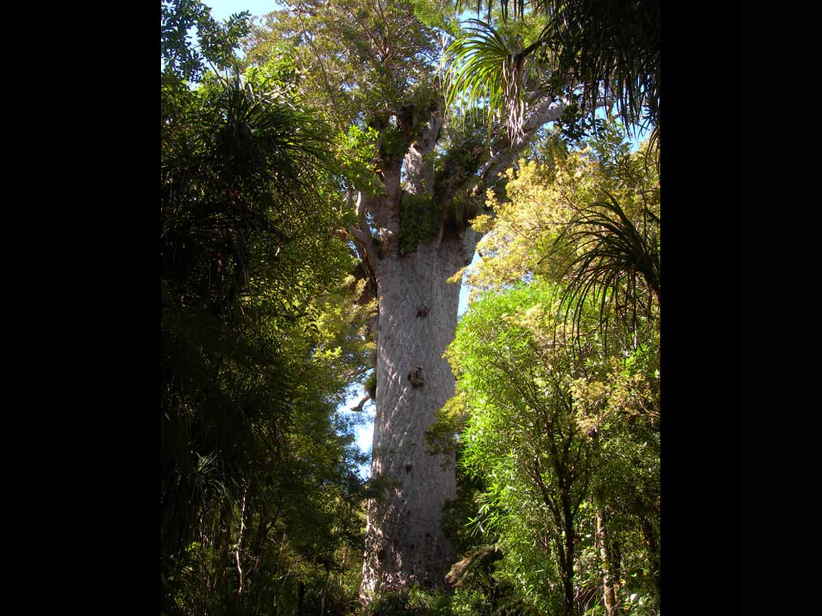
Kauri Landscape, New Zealand — Kauri (Agathis australis) trees are endemic to the North Island of New Zealand. These long-lived conifers produce very thick piles (up to 1 m) of litter around the trunk. Leachates from the litter strongly affect both the chemistry and morphology of the “egg-cup” Spodosols that form beneath. The kauri shown here is estimated to be approximately 2,000 years old and is the largest living specimen in New Zealand with a girth of 13.8 m (45 ft) and height of 51.5 m (169 ft). (Image from University of Idaho)