


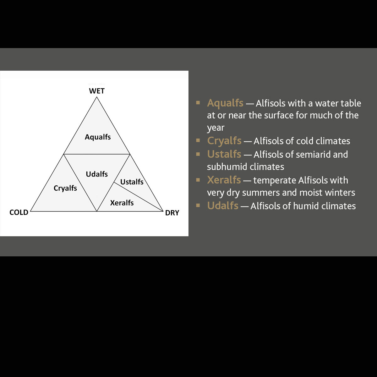
Alfisols
Alfisols are moderately leached soils that have relatively high native fertility. These soils have mainly formed under forest and have a subsurface horizon in which clays have accumulated. Alfisols are primarily found in temperate humid and subhumid regions of the world. The combination of generally favorable climate and high native fertility allows Alfisols to be very productive soils for both agricultural and silvicultural use. They are divided into five suborders: Aqualfs, Cryalfs, Udalfs, Ustalfs and Xeralfs.
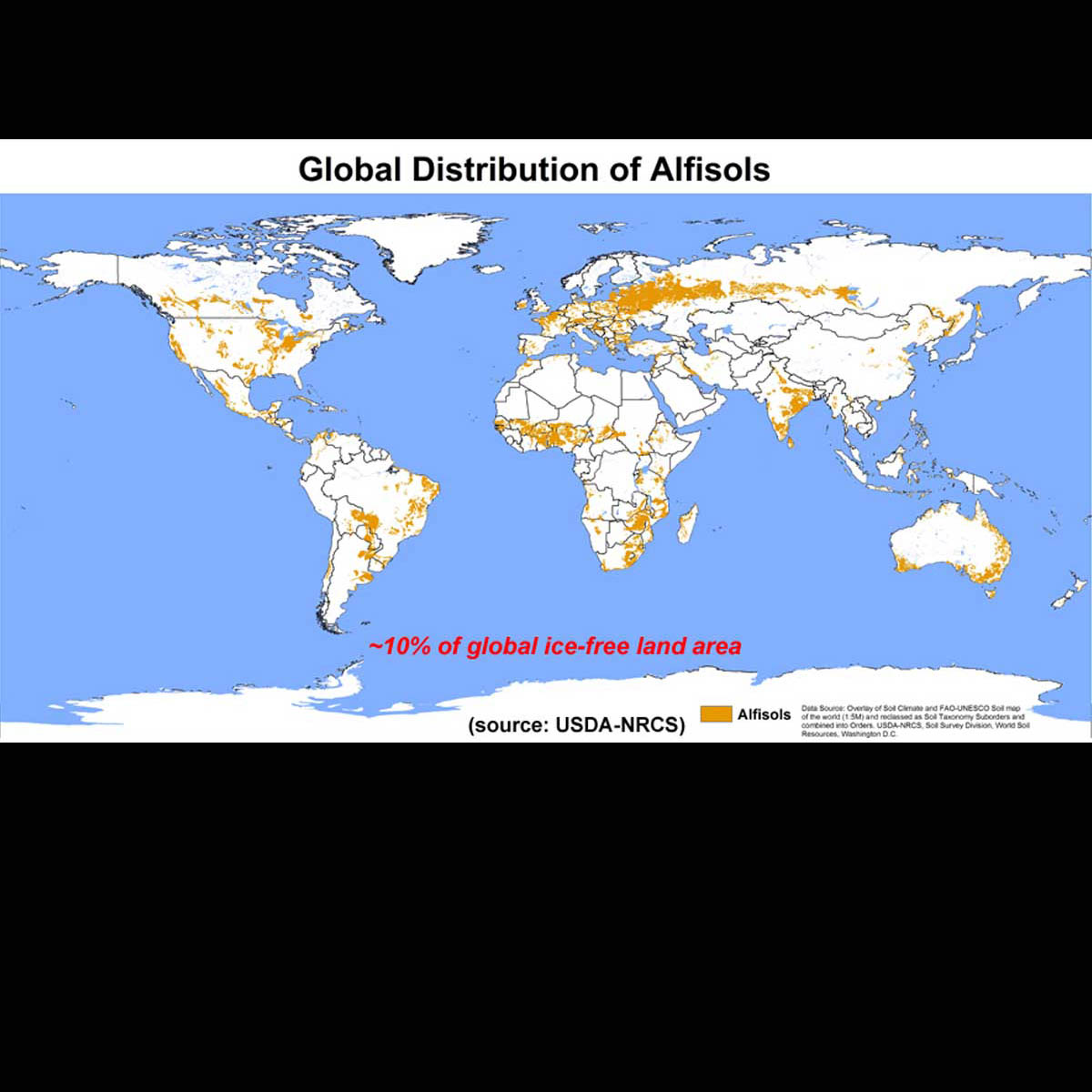
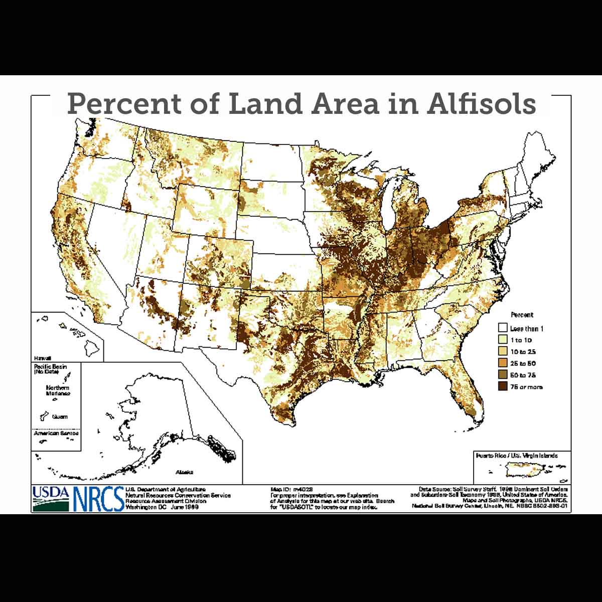
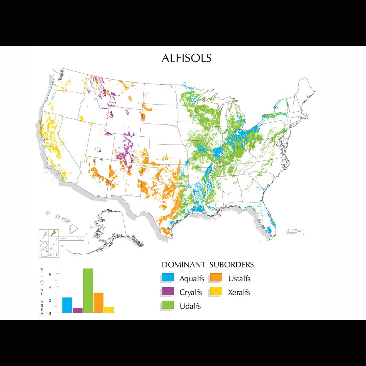
Alfisols occupy approximately 10.1% of the global ice-free land area. In the U.S., they account for approximately 13.9% of the land area. They support about 17% of the world's population.

Alfisols have both: (1) a subsurface zone of clay accumulation — either an argillic, kandic or natric horizon; and (2) base saturation of at least 35 percent in the subsoil. This second criterion is what distinguishes Alfisols from Ultisols. (USDA-NRCS image)
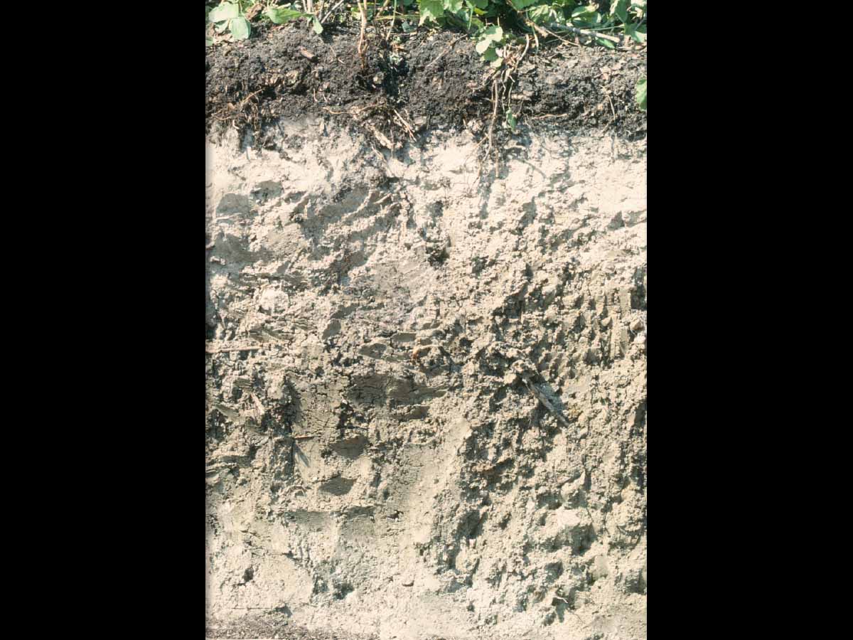
Alfisols have both: (1) a subsurface zone of clay accumulation — either an argillic, kandic or natric horizon; and (2) base saturation of at least 35 percent in the subsoil. This second criterion is what distinguishes Alfisols from Ultisols. (USDA-NRCS image)
Previous
Next
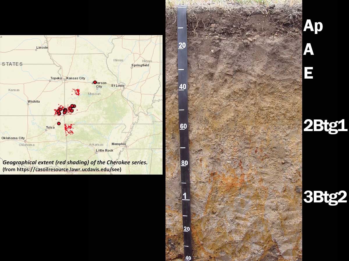
Typic Albaqualf (fine, mixed, active, thermic), northwestern Arkansas — This very deep, somewhat poorly drained soil belongs to the Cherokee series and has formed in fine-textured sediments on terraces, upland benches and at the heads of drainages. A seasonal perched water table is typically within 25-50 cm of the soil surface between January and May. As a result, redoximorphic features are abundant in the fine-textured argillic Btg horizons. Mean annual precipitation is approximately 890-1140 mm (35-45 inches). (Image by Dr. K. Brye, from Soils of Arkansas. 2013. Arkansas Ag. Exp. Station, University of Arkansas System Division of Agriculture, Fayetteville, AR)
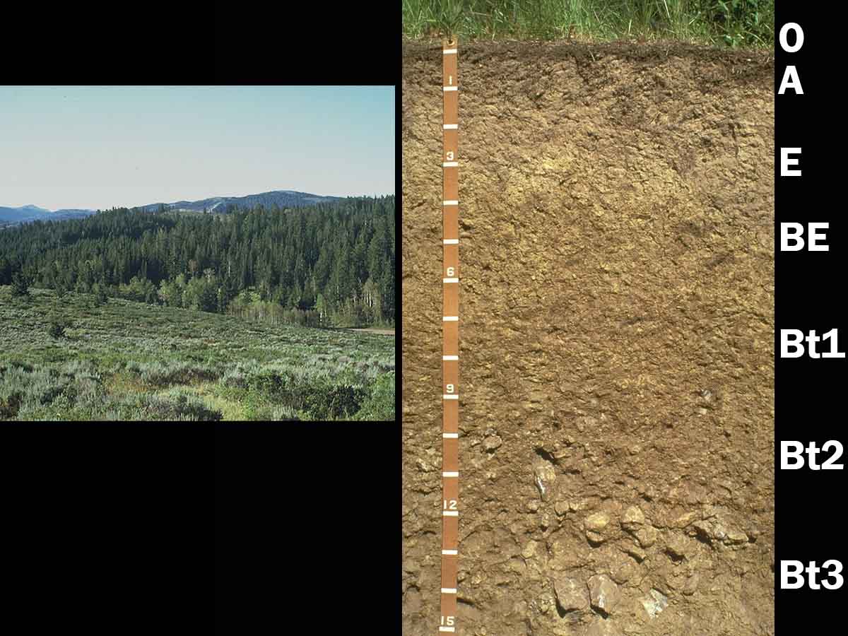
Haplocryalf, southeastern Idaho — This landscape and soil are typical of the mountainous areas of southeastern Idaho at elevations ranging from approximately 2,000-4,240 m (6,600-8,000 ft). Mean annual precipitation is approximately 635 m (25 inches). Mollisols are associated with the shrub/grassland communities on southerly aspects and Haplocryalfs with forest. Because of the cryic temperature regime, these soils are used primarily for timber production, some livestock grazing and recreation. Parent material is loess overlying limestone residuum. Leaching is facilitated by the cool, moist climate and has moved calcium carbonate to considerable depth. This has allowed clay to move and accumulate in the argillic Bt horizons. Textures are silt loam in the E horizon and silty clay loam in the Bt horizons. (Images from University of Idaho)
Previous
Next
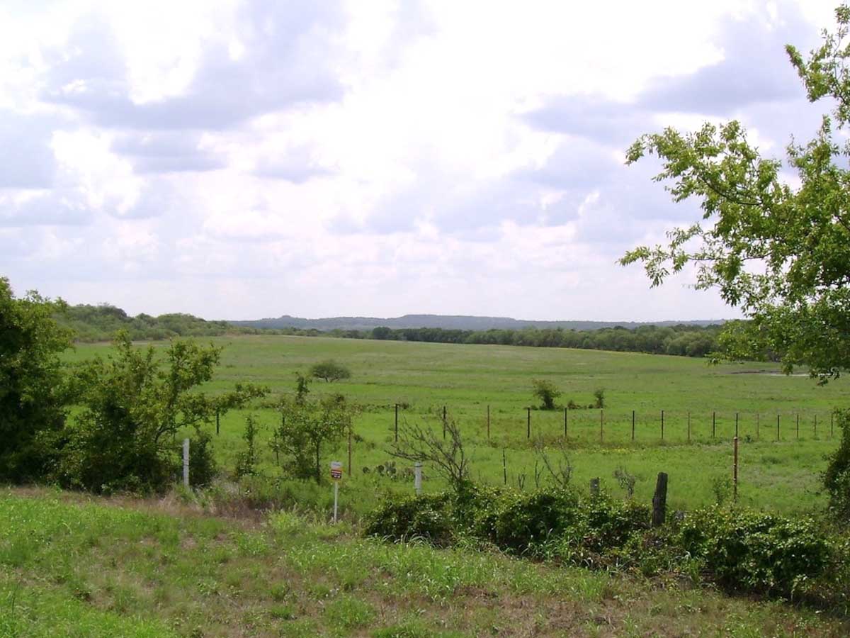
Paleustalf Landscape, northcentral Texas — This gently undulating landscape is representative of the Cross Timbers Area of northcentral Texas and southcentral Oklahoma. Mean annual precipitation ranges from 660-1065 mm (26-42 inches) and mean annual temperature is approximately 17-19°C (62-66°F). Native vegetation is savanna, including blackjack oak (Quercus marilandica), post oak (Quercus stellata), and a ground cover of little bluestem (Schizachyrium scoparium) and other grasses. Most of the area is in pasture and used for grazing. Some areas are cultivated, with peanuts, sorghum and small grains the main crops. (Image from https://en.wikipedia.org/wiki/Cross_Timbers#/media/File:Jack_County.jpg)
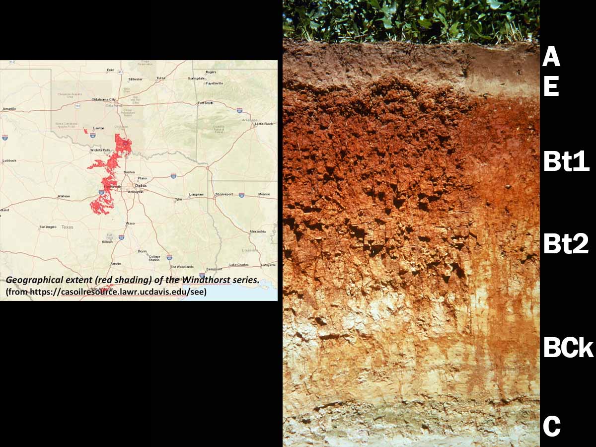
Udic Paleustalf (fine, mixed, active, thermic), northcentral Texas — This very deep soil is a member of the Windthorst series and has formed in sandy and clayey residuum. These soils are extensive on old erosional uplands in northcentral Texas and southcentral Oklahoma. A and E horizon textures range from loamy very fine sand to fine sandy loam. Clay content increases abruptly to approximately 40-50 percent in the argillic Bt horizon (Pale- subgroup classification). (Image reproduced from Soils of the Great Plains: Land Use, Crops and Grasses by Andrew R. Aandahl by permission of the University of Nebraska Press. Copyright 1982 by the University of Nebraska Press)
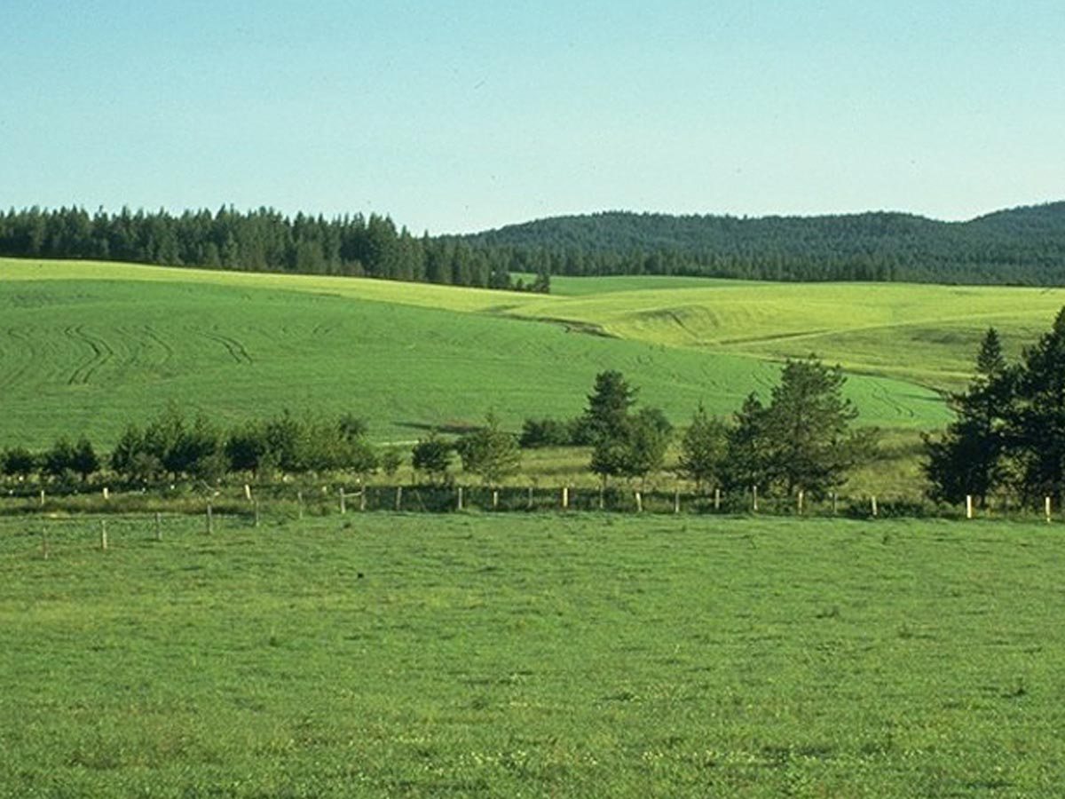
Fragixeralf Landscape, northern Idaho — This rolling landscape is typical of the eastern edge of Palouse region of northern Idaho. Loess, reworked loess, and volcanic ash mantle the landscape. Grand fir (Abies grandis) forests were partially cleared for agriculture beginning in the late 19th century. Mean annual precipitation is about 760 mm (30 inches). The frigid temperature regime limits crop selection to winter wheat and pasture. These soils have very slow permeability and a limited rooting depth due to the presence of a fragipan. A perched water table is typically present from December until May. Surface-applied fertilizers can be transported laterally via these perched water tables, creating both economic and environmental concerns. (Image from University of Idaho)
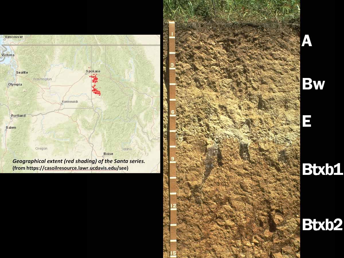
Vitrandic Fragixeralf (coarse-silty, mixed, superactive, frigid), northern Idaho — This soil is a member of the Santa series and has formed in loess. This is a multi-generational soil — it has formed in two different-aged loess deposits. The A, Bw and part of the E horizons have formed in younger loess that is approximately 10,000 yrs old. Some volcanic ash is mixed with the loess in the surface horizon (Vitrandic subgroup). A fragipan (Btxb) is part of an older, buried soil that began forming approximately 40,000 yrs ago. The dense fragipan is very slowly permeable and significantly alters local hydrology. Relatively little water is able to percolate through the fragipan, resulting in considerable lateral throughflow across the landscape. (Image from University of Idaho)
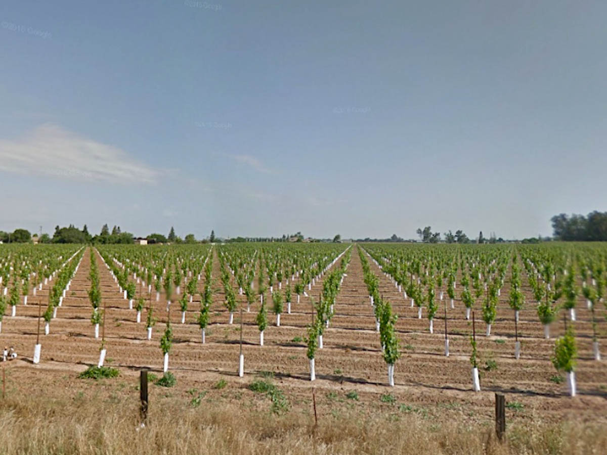
Durixeralf Landscape, central California — Xeralfs dominate this nearly level Central Valley landscape north of Lodi. This region ranks among the most productive agricultural regions in the world. Parent material is old, mixed alluvium derived from uplands adjacent to the valley. Mean annual precipitation is only about 380 mm (15 inches) so most agricultural production is irrigated. These soils are extensively used for vineyards, irrigated pasture, small grains and rice production, and fruit and nut crops. (Image from Google Maps)
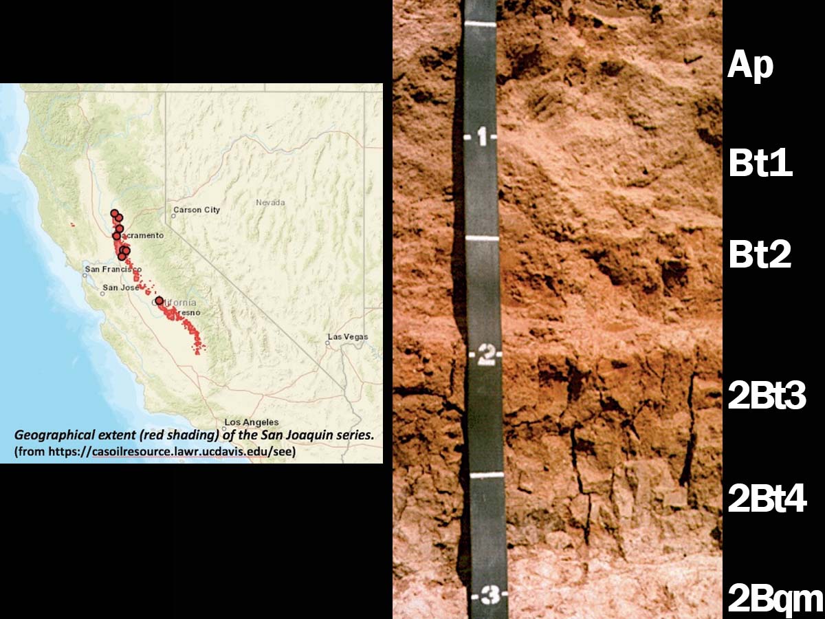
Abruptic Durixeralf (fine, mixed, active, thermic), California — This moderately deep soil is a member of the San Joaquin series, which is the state soil of California. More than 200,000 hectares (500,000 acres) of San Joaquin soils have been mapped in California’s Central Valley. These soils have formed in old alluvium on low terraces. Prominent features of San Joaquin soils include a clayey subsoil (2Bt horizons) and a silica-cemented duripan (2Bqm horizon). As a result, these soils have very slow permeability. Scale is in feet. (Image from the Professional Soil Scientists Association of California)
Previous
Next
Mollic Hapludalf, Iowa Co., Wisconsin — This very deep, well-drained soil occurs on upland side slopes and foot slopes. It has formed in loess over colluvium. Mean annual precipitation is approximately 760-860 mm (30-34 inches). The native vegetation is mixed deciduous trees and grasses. As a result, the dark surface gives this soil the appearance of a Mollisol, but it lacks one or more of the required characteristics (e.g., epipedon thickness, base saturation, etc.). Alfisols like this one are considered transitional to Udolls both in terms of morphology and location. On gentler slopes these soils are used for cropland; those on steeper slopes are typically used for woodland. (Image courtesy of Dr. Randy Schaetzl, Michigan State University)
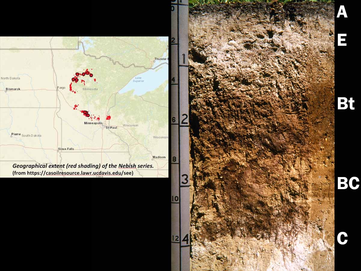
Typic Hapludalf (fine-loamy, mixed, superactive, frigid), northcentral Minnesota — This very deep, well-drained soil is a member of the Nebish series and has formed on uplands in late Wisconsin calcareous glacial till. Mean annual precipitation is approximately 510-710 mm (20-28 inches). The argillic Bt horizon typically contains 28-35 percent clay. The frigid temperature regime limits crop selection and most areas of these soils are in mixed deciduous/coniferous forest. (Image reproduced from Soils of the Great Plains: Land Use, Crops, and Grasses by Andrew R. Aandahl by permission of the University of Nebraska Press. Copyright 1982 by the University of Nebraska Press)
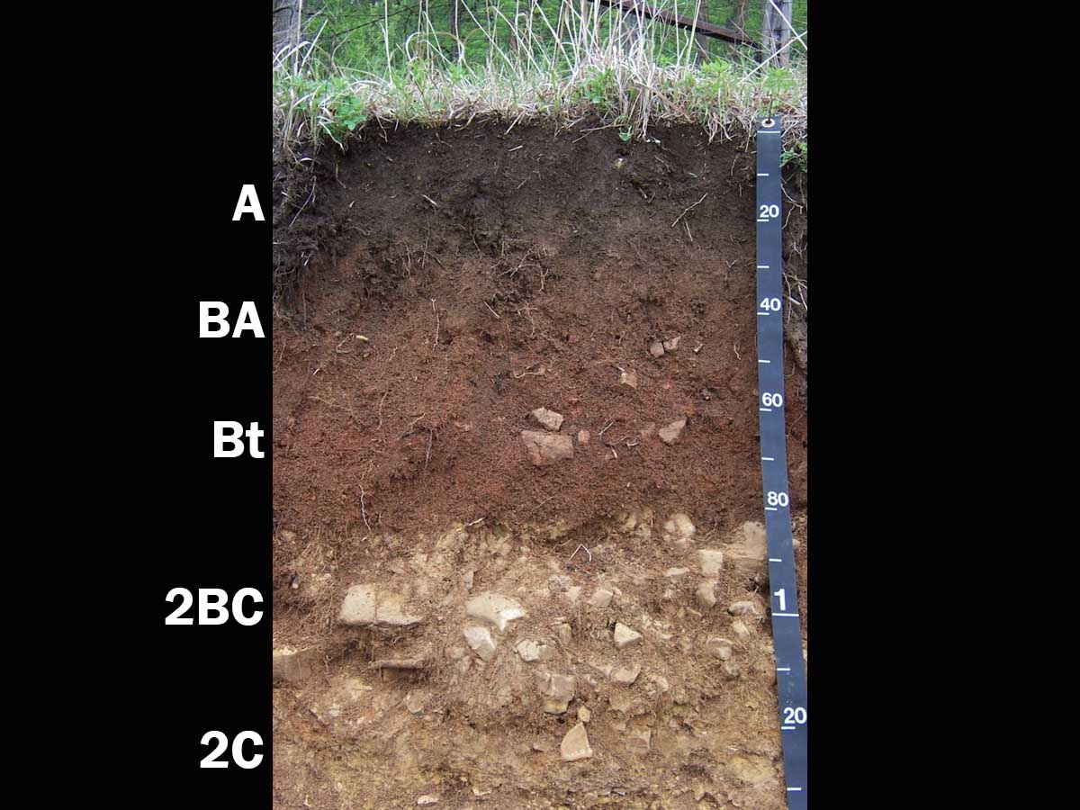
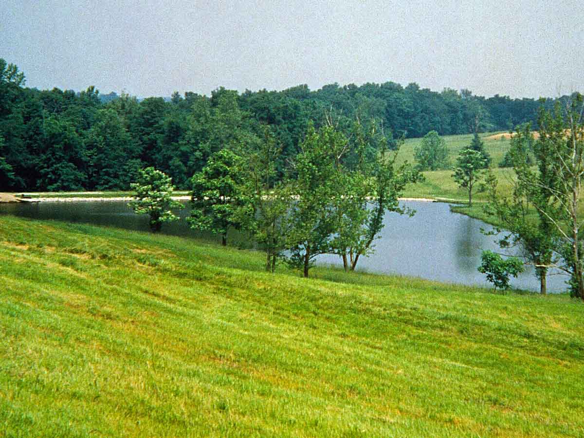
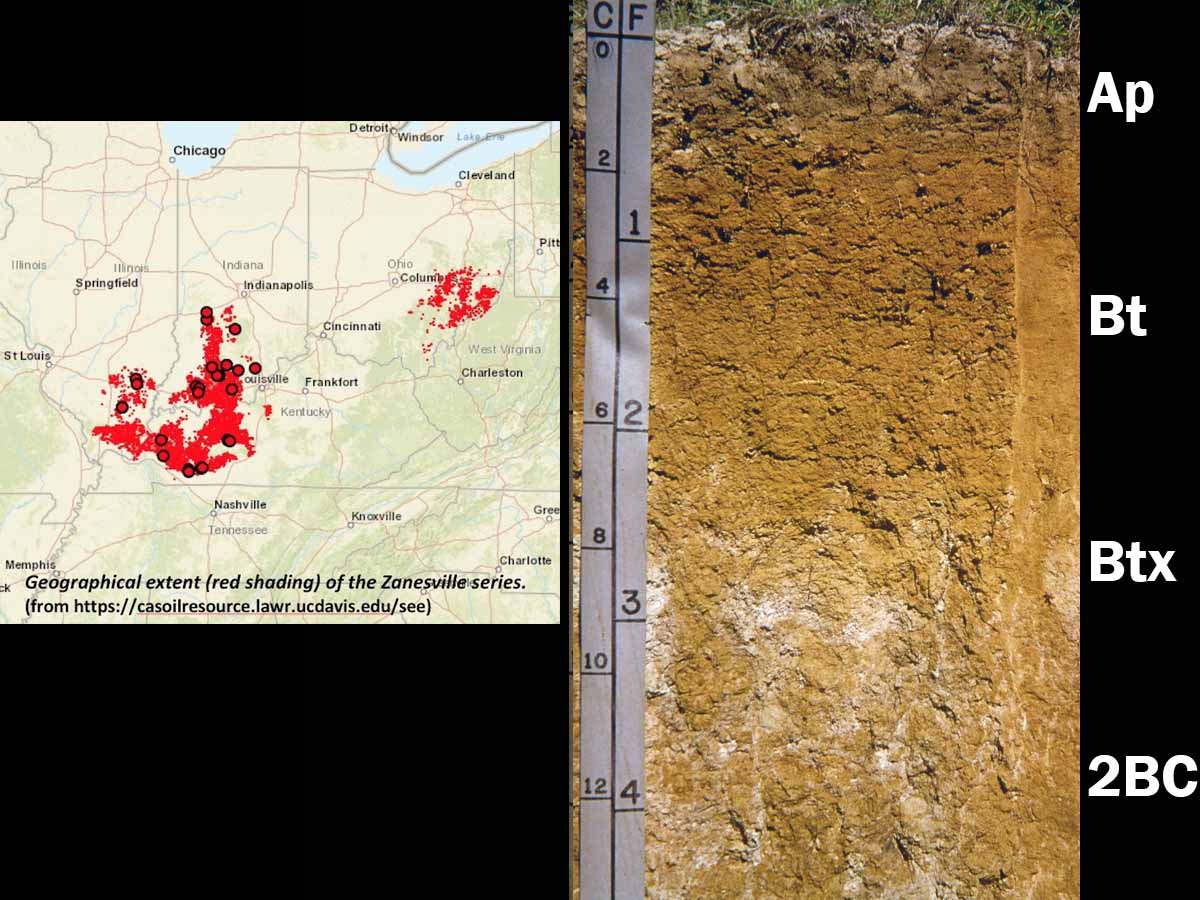
Fragiudalf Landscape, southern Indiana — Fragiudalfs occur on the summit, shoulder and backslope positions of this loess-mantled landscape. The loess ranges in thickness from approximately 60-120 cm (24-47 inches) and is underlain by residuum derived from acid sandstones, shales and siltstones. Mean annual precipitation ranges from approximately 1,000-1,300 mm (39-51 inches). Native vegetation consists of hardwood forest, although most of these areas are used for crop production. (Image reproduced from Soils of the Great Plains: Land Use, Crops and Grasses by Andrew R. Aandahl by permission of the University of Nebraska Press. Copyright 1982 by the University of Nebraska Press)