


Aridisols
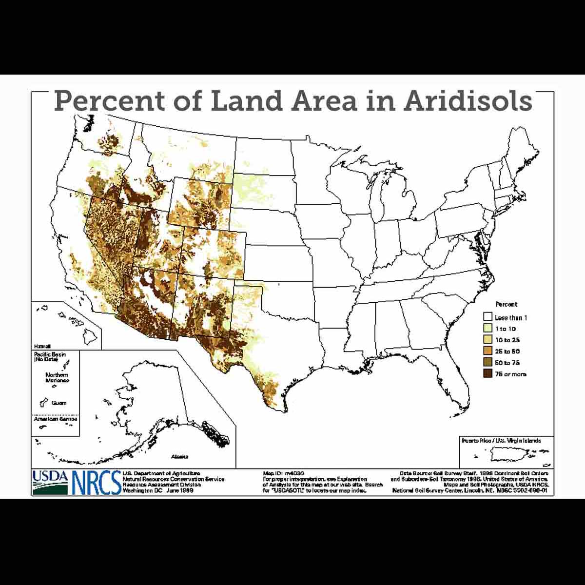
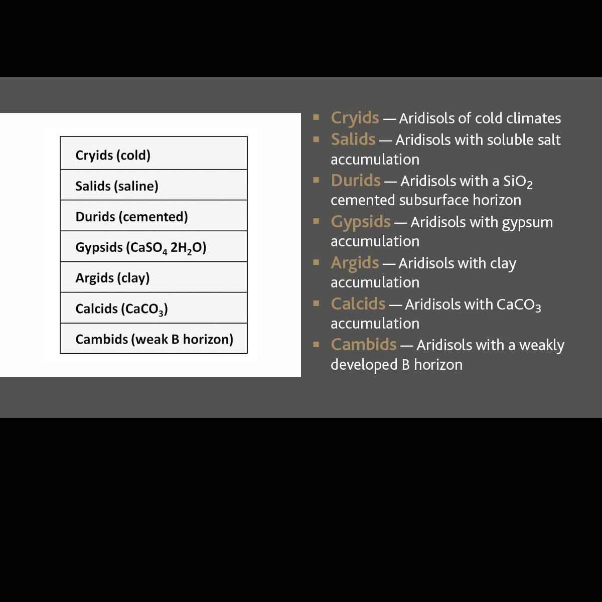
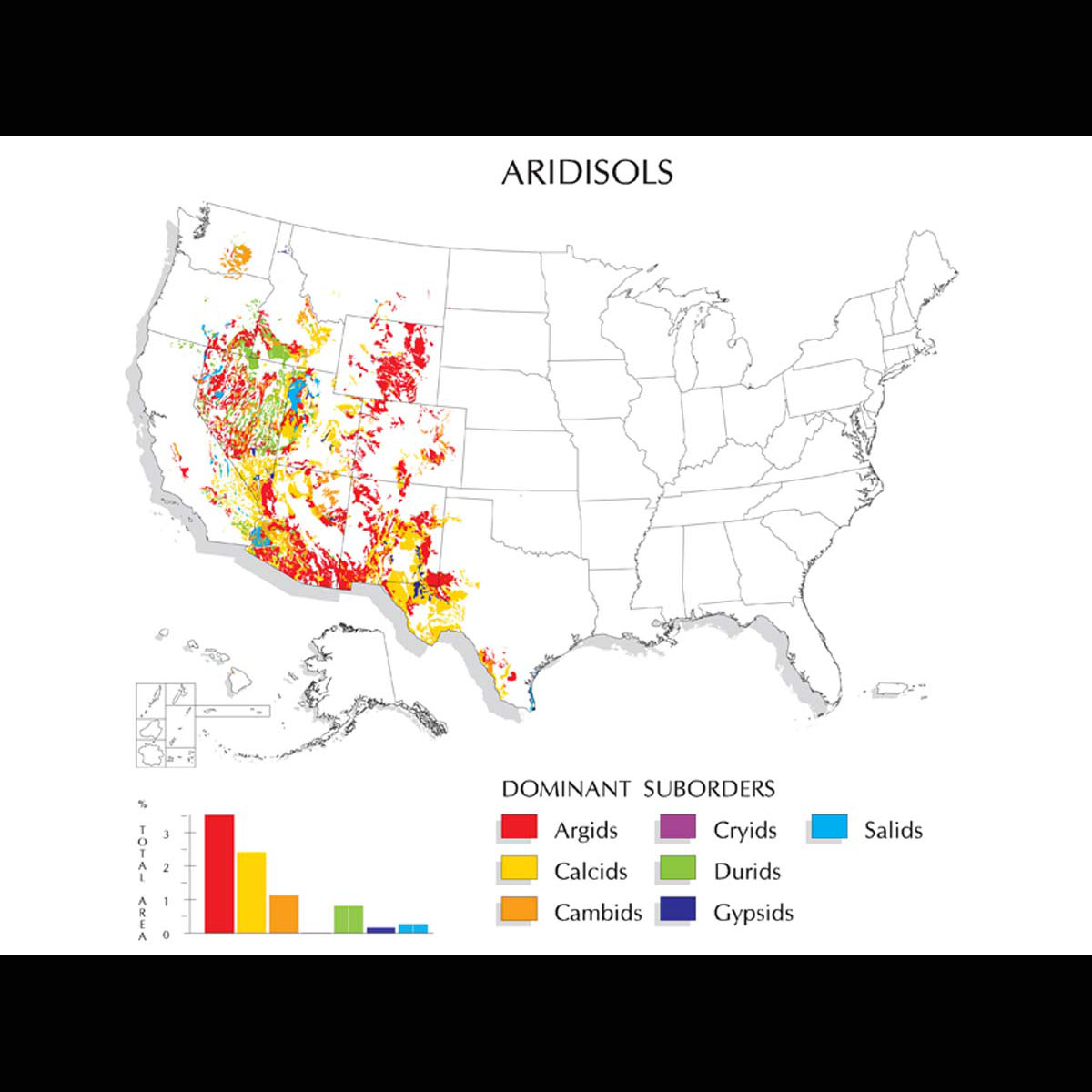
Aridisols (from Latin aridus, "dry") are CaCO3-containing soils of arid regions that exhibit subsurface horizon development. They are characterized by being dry most of the year and limited leaching. Aridisols contain subsurface horizons in which clays, calcium carbonate, silica, salts and/or gypsum have accumulated. Materials such as soluble salts, gypsum and CaCO3 tend to be leached from soils of moister climates. They are divided into seven suborders: Cryids, Salids, Durids, Gypsids, Argids, Calcids and Cambids.
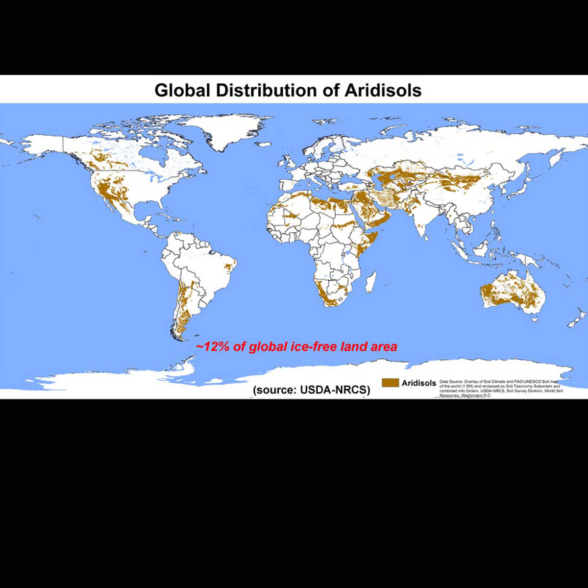
They are used mainly for range, wildlife and recreation. Because of the dry climate in which they are found, they are not used for agricultural production unless irrigation water is available. Aridisols occupy approximately 12% of the Earth's ice-free land area and approximately 8.3% of the U.S.

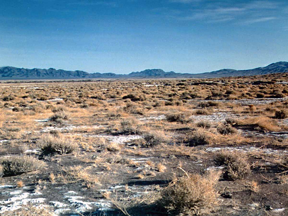
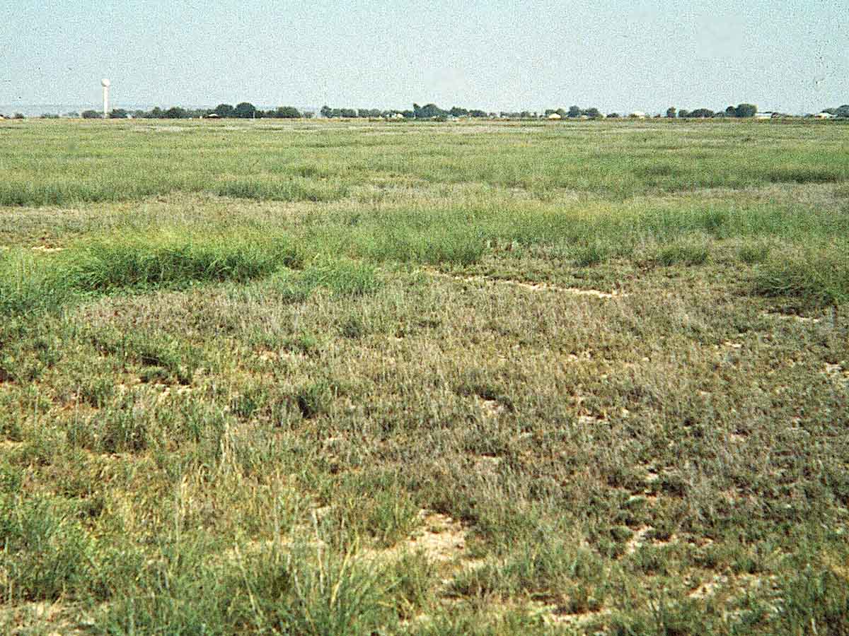
Aquisalid Landscape, central Nevada — Salt crusts are visible at the soil surface in this Basin and Range landscape. Salts accumulate in low-lying areas of the basin as surface runoff and seasonal high water tables transport dissolved salts to or close to the soil surface. As water evaporates, the salts are left behind. Few plants are able to tolerate areas of the basin where high salt concentrations are greatest. (Image from the Soil Science Society of America Marbut Memorial Slide Set)
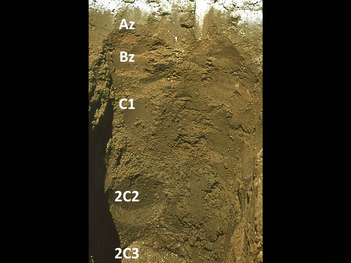
Typic Aquisalid, Nevada — This soil is found in basins and playas of the Basin and Range Province of the U.S. The white crust at the soil surface is a mixture of various soluble salts and indicates the presence of a salic horizon (Az , Bz horizons). Salinity is sufficiently high to inhibit the growth of most plant species. Species that grow in these soils are classified as halophytes and include Brickell bush (Brickellia sp.) and salt grass (Distichlis stricta). (Image from the Soil Science Society of America Marbut Memorial Slide Set)
Gypsid Landscape, New Mexico — Gypsids and Calcids are the dominant soils on this native rangeland landscape. Mean annual precipitation ranges from 250 -380 mm (10-15 inches) and mean annual temperature ranges from 14-18°C (58-64°F). Gypsiferous sedimentary rocks provide a source of gypsum (CaSO4•2H2O) found in many of the soils. Because of the aridic regime, these areas are used for livestock grazing unless irrigation water is available. (Image reproduced from Soils of the Great Plains: Land Use, Crops and Grasses by Andrew R. Aandahl by permission of the University of Nebraska Press. Copyright 1982 by the University of Nebraska Press)
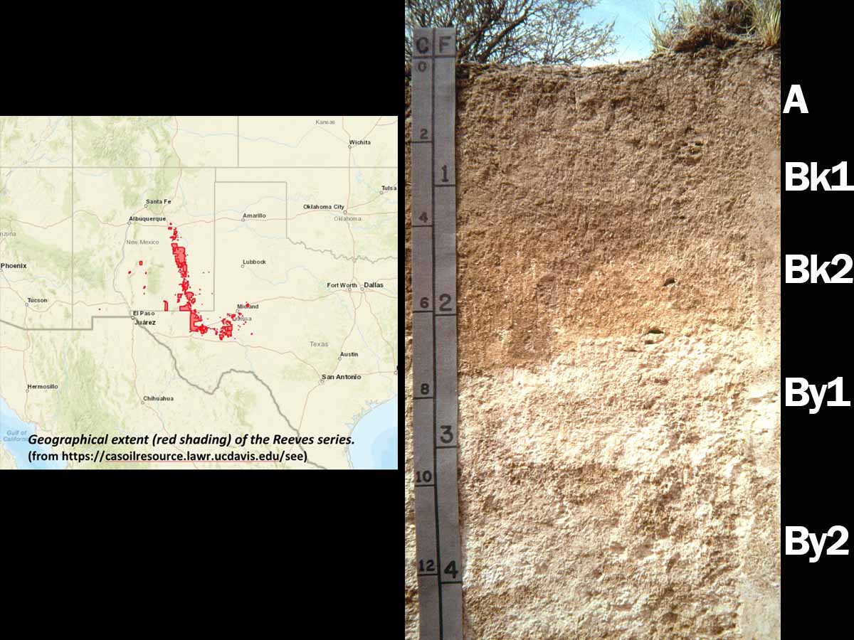
Ustic Calcigypsid (fine-loamy, gypsic, thermic), New Mexico — This very deep soil belongs to the Reeves series and has formed in calcareous and gypsiferous fine-textured alluvium. These soils are found on nearly level to gently sloping basin floors, plateaus and hillslopes. Features include both calcic (Bk) and gypsic (By) diagnostic horizons. Because gypsum (CaSO4•2H2O) is more soluble than CaCO3, it typically accumulates deeper in the soil profile. Reeves soils are used for grazing and irrigated cropland. (Image reproduced from Soils of the Great Plains: Land Use, Crops and Grasses by Andrew R. Aandahl by permission of the University of Nebraska Press. Copyright 1982 by the University of Nebraska Press)
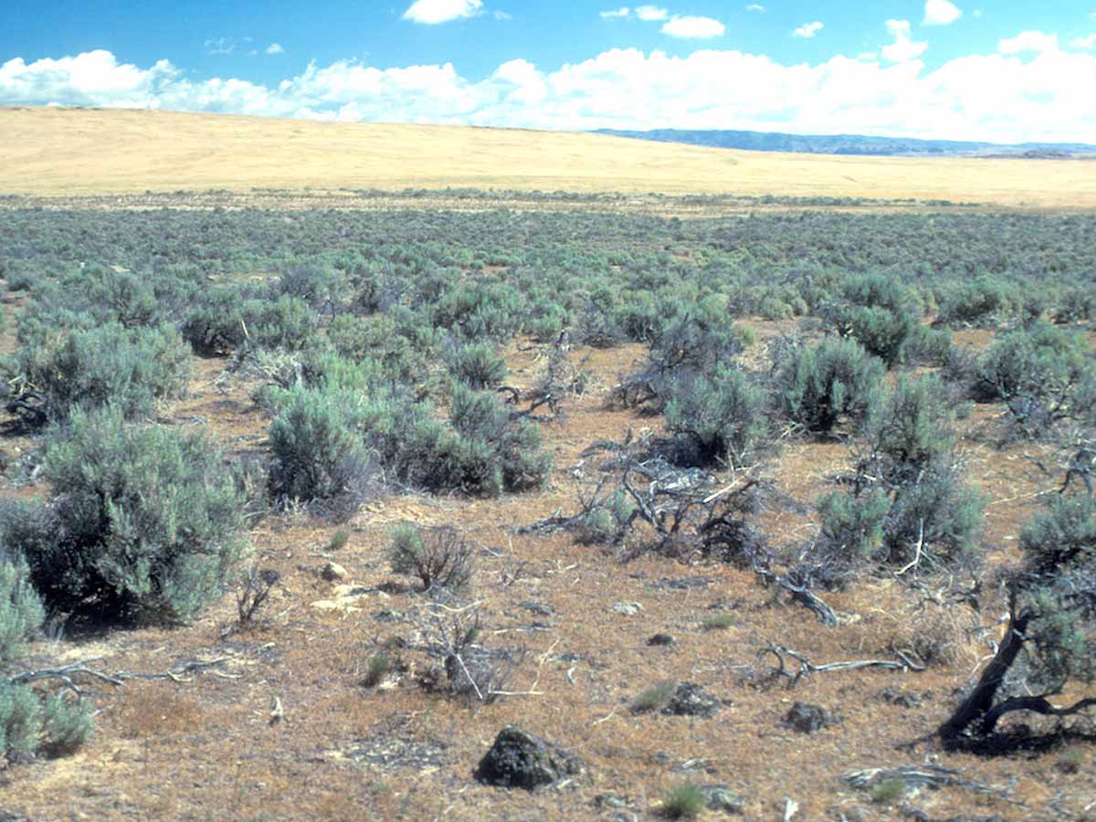
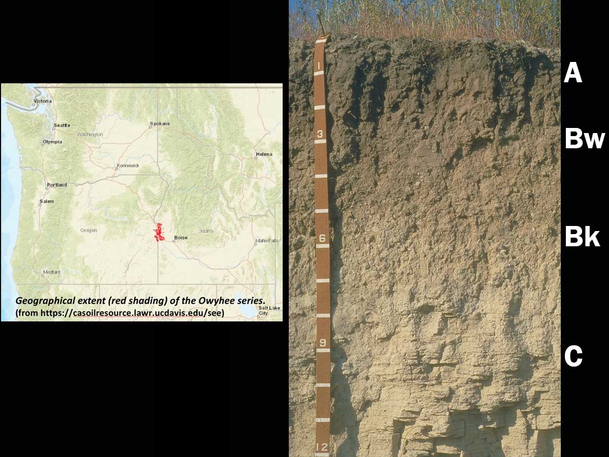
Argidurid Landscape, Elmore County, Idaho — Soils of these older landscapes commonly contain a silica- and CaCO3-cemented duripan at a relatively shallow depth. The duripan impedes the downward growth of roots and the movement of water in the profile. These landscapes receive approximately 25 cm (10 inches) of mean annual precipitation and are used mainly for rangeland. However, in areas where the soil is deeper, some irrigated crop production does occur. Vegetation in the potential natural plant community is mainly Wyoming big sagebrush (Artemisia tridentata ssp. wyomingensis), bluebunch wheatgrass (Pseudoroegneria spicata), Sandberg bluegrass (Poa secunda) and Thurber’s needlegrass (Achnatherum thurberianum). (Image from University of Idaho)
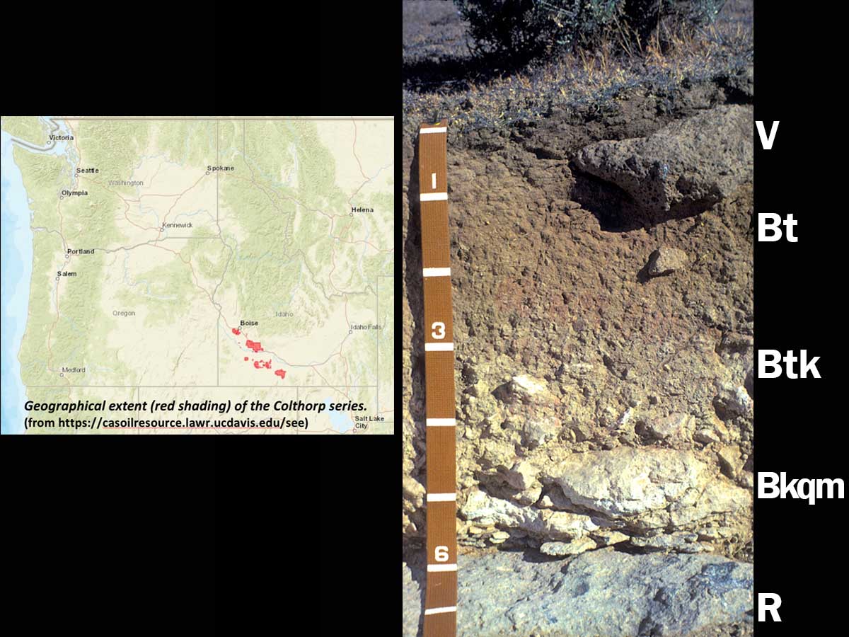
Xeric Argidurid (fine-silty, mixed, superactive, mesic, shallow) — This soil is a member of the Colthorp series and is found on basalt plains and terraces. These soils are moderately deep to bedrock and contain a CaCO3- and SiO2-cemented duripan (Bkqm horizon) at shallow depth. Basalt bedrock can be seen at a depth of ~60 cm (scale is in decimeters). The presence of the duripan and basalt bedrock at such shallow depths creates problems for engineering uses where excavation is required. (Image from University of Idaho)
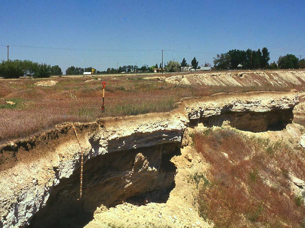
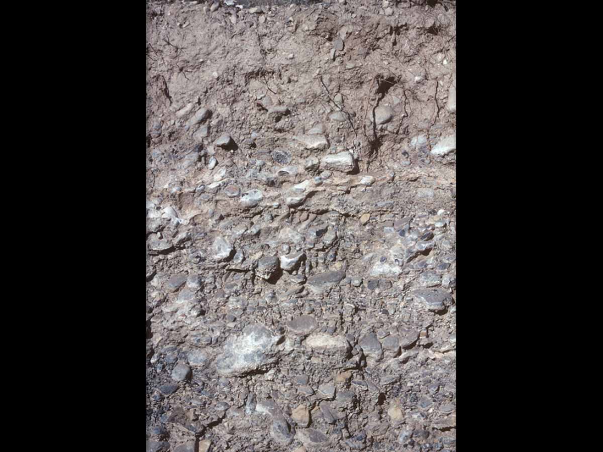
Duripan Exposure, Ada County, Idaho — This exposure shows the prominent duripan that is the distinguishing feature of many old Aridisols in the Boise Valley area of Idaho. Duripans such as these require long periods of time to form. Research in this area suggests that at least 130,000 years are required to develop the initial stages of a duripan. The dominant soils of the approximately 600,000 year-old terrace shown here have well-developed duripans. These old surfaces have undergone multiple cycles of erosion and deposition that have alternately exposed the developing duripan and then reburied it with eolian deposits. (Image from University of Idaho)
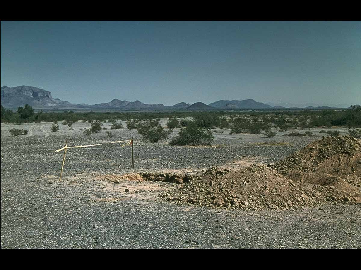
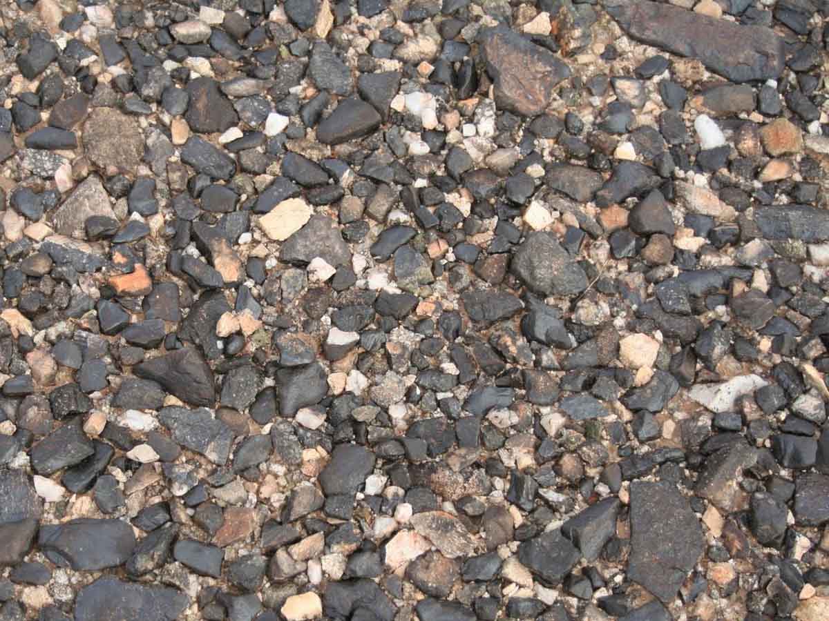
Argid/Cambid Landscape, central Arizona — This landscape is typical of the Sonoran Desert of the southwestern U.S. Soils classified as Argids and Cambids have formed at the base of the alluvial fan on the right side of the photo. The land surface has a well-developed desert pavement. Mean annual precipitation is approximately 250 mm (10 inches) and summers are very hot. Native vegetation consists of mesquite (Prosopis spp.) and saguaro cactus (Carnegia gigantea). (Image from the Soil Science Society of America Marbut Memorial Slide Set)
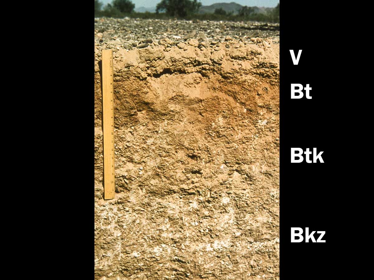
Typic Haplargid, central Arizona — This soil has formed on older alluvial fans and is mantled by the desert pavement seen in the previous landscape image. The desert pavement is approximately 5 cm (2 inches) thick and overlies a highly vesicular V horizon. Calcium carbonate has been leached to depth of approximately 36 cm (14 inches), allowing some clays to accumulate in the darker brown, argillic Bt horizon. Some soluble salts are also present in the lower part of the profile. Ruler for scale is 48 cm (18 inches) long. (Image from the Soil Science Society of America Marbut Memorial Slide Set)
Sonoran Desert Pavement — Two main models have been proposed to explain the formation of desert pavement. In one model, rock fragments simply accumulate at the land surface as fine particles are removed by wind and/or water. A second model proposes that in rocky soils, finer, wind-blown particles accumulate at the soil surface. As the fine particles move down into the rocky matrix, they eventually lift rock fragments upward to form the pavement. Shrink/swell and freeze/thaw may also contribute to this process. The desert pavement both protects the finer particles from removal and facilitates the accumulation of more dust. (Image from http://practicalbio.blogspot.com/2011/08/desert-pavement.html)
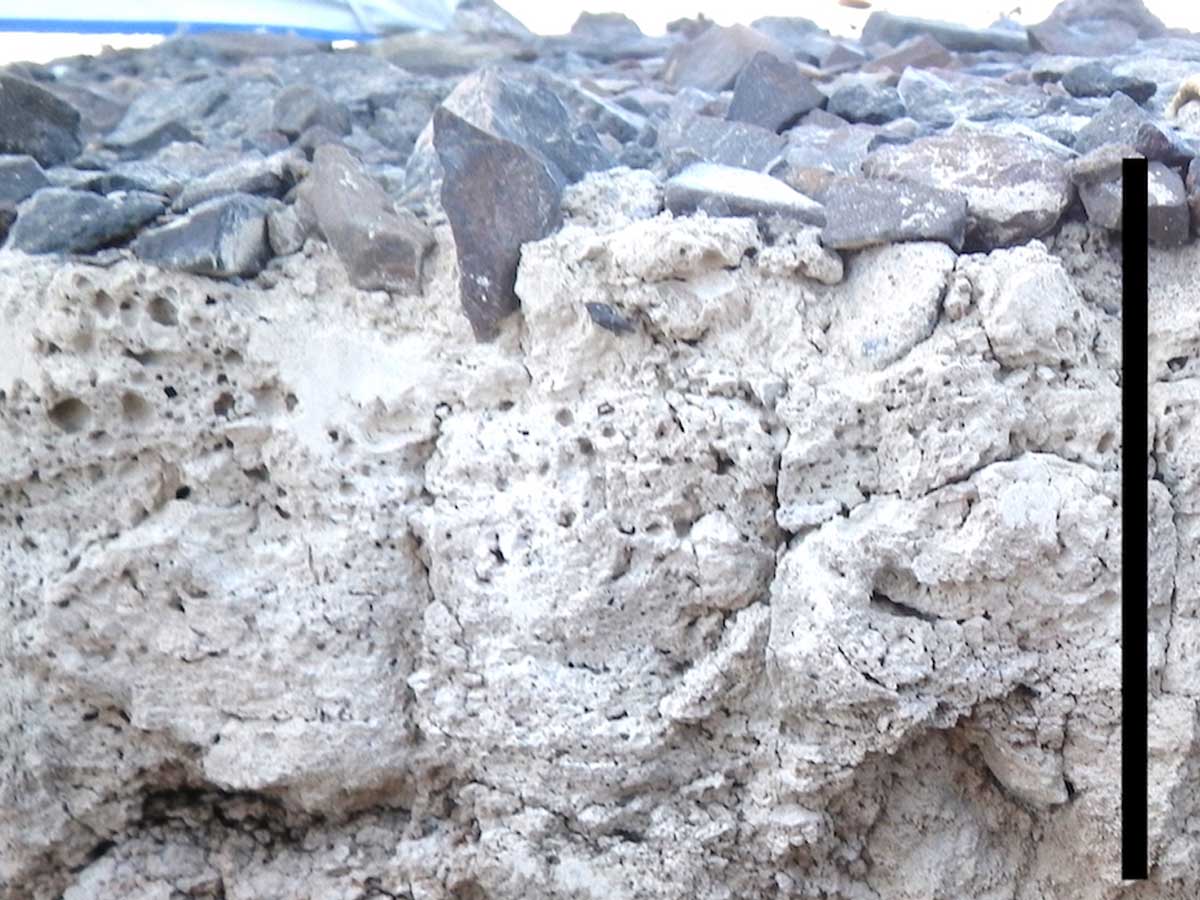
V Horizon Underlying Desert Pavement — V horizons are characterized by the presence of poorly connected vesicular (bubble-like) pores. These pores most often form in wind-deposited sediments when air bubbles are trapped in the soil as it wets up during high-intensity rainfall events. The bubble cavities then remain as the soil dries out rapidly. As this process is repeated over time, the vesicular pores become enlarged and eventually collapse creating a dense, slowly permeable V horizon. Black bar for scale is 10 cm (4 inches) long. (Image from Dr. Judy Turk, University of Nebraska)
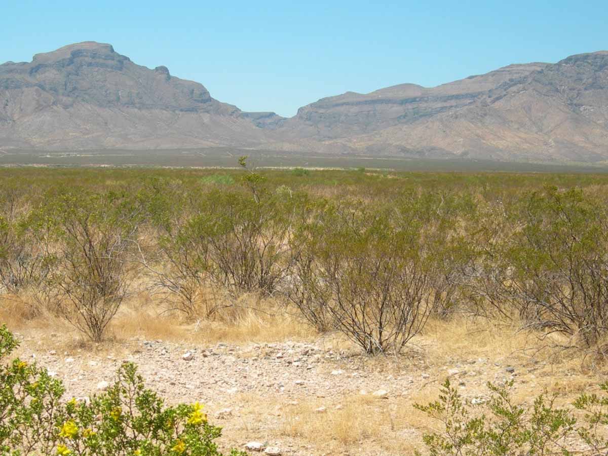
Petroargid Landscape, southern New Mexico — This Basin and Range landscape from southern New Mexico consists of a large alluvial basin floor (foreground) flanked by alluvial fans and mountains (background). The most highly developed soils such as Petroargids are found on the older alluvial fan surfaces at the base of the mountains. Mean annual precipitation is approximately 250 mm (10 inches). Vegetation includes black grama (Bouteloua sp.), mesquite (Prosopis sp.) and yucca (Yucca sp.). (Image from University of Idaho)
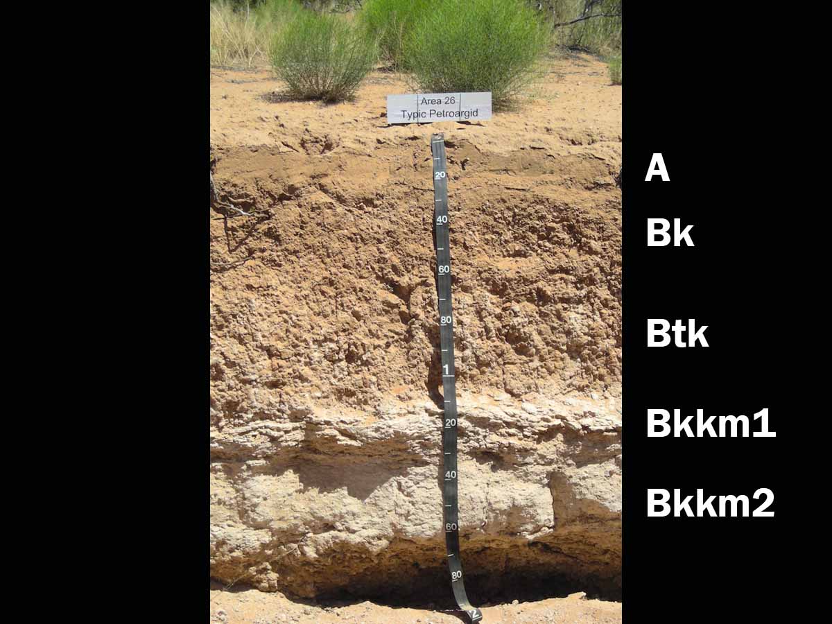
Typic Petroargid, New Mexico — This soil formed in alluvial sediments in a basin of southern New Mexico. The thick CaCO3-cemented (Bkkm) horizon is known as a petrocalcic horizon or caliche and exhibits Stage IV development (see next image). Several hundred thousand years are required to reach this advanced stage of development. Based on research done at this site, the soil is estimated to be approximately 700,000 years old. Scale is in centimeters. (Image and information courtesy of Dr. Curtis Monger)

Stages of Calcium Carbonate Accumulation — This diagram illustrates the various stages of CaCO3 accumulation in finer-textured Aridisols based on work done in the southwestern US. The age of an Aridisol in New Mexico with Stage VI CaCO3 accumulation is estimated to be approximately 1.6 million years. (Image from USDA-NRCS Field Book for Describing and Sampling Soils, Version 3.0)
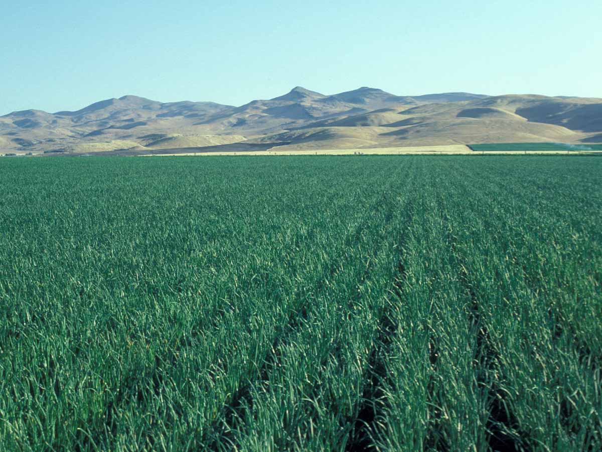
Haplocalcid Landscape, Washington County, Idaho — Soils of this landscape have formed in silty lacustrine sediments and contain an accumulation of calcium carbonate in the subsoil. Mean annual precipitation is only approximately 250 mm (10 inches), but agricultural production is made possible by the availability of good-quality irrigation water and a frost-free season ranging between 110-170 days. These soils are used to grow a variety of crops including wheat, potatoes, corn, sugar beets, mint and onions. (Image from University of Idaho)